Coastal wind scenario
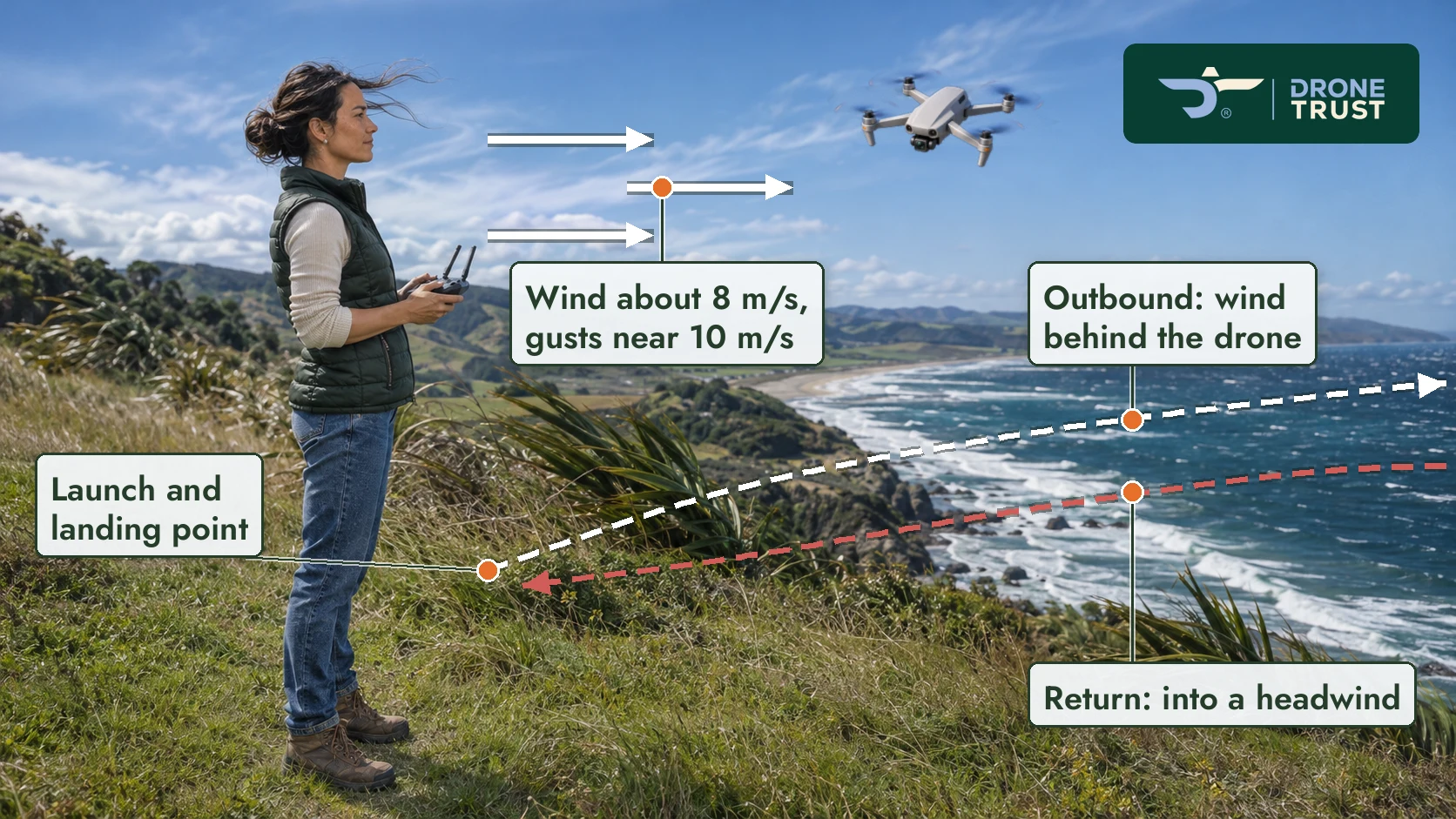
Windy coastline with the drone's outbound and return paths drawn over it.
L2.2-G1 Open The wind as drawn makes the return leg a headwind, while the text says the drone "may" face one. Fine, or draw it so it's less certain?
Training content questions: please answer as we go. Graphics are going live as they are; Clive will review them all once Part 101 is built. This page grows as new lessons are added.
Open now: 20 training content, 13 graphics. Tap any picture to open it full size. Answers you type here stay on this device until you export them.
New, 19 Nov: CATI 101-1 summary (Word) — where the CATI introduction went, every wording change and what was checked.
Last updated 19 November 2026, 11:55 AM NZ
CATI-C1 Open Night (and shielded) operations aren't taught anywhere in Modules 1–3, though the course overview video says Module 2 covers them. Add a short section, and where (e.g. Lesson 2.3 or 2.4)? Draft wording based on CATI 2.11 is in the summary, section 9.
CATI-C2 Open "ATC clearance" or "ATC authorisation" in Lessons 3.2 and 3.3? Rule 101.11 and CATI 2.3 say authorisation; the CAA's Part 101 web page says clearance. Either is defensible (this also answers L3.3-C4).
CATI-C3 Open Lessons 2.2 and 2.3 already mention CATI 101-1 in trainee text ("…Rules 101.202 and 101.215 and CATI 101-1." / "Under CATI 101-1, this is permitted where:"). Keep them, or change to "Part 101" now that 2.1 introduces the CATI?
CATI-C4 Open Lesson 3.4 Danger Areas: align with rule 101.7(c)? Proposed: "Before a Part 101 flight in a danger area, you must establish that the activity associated with the danger area will not affect the safety of any person or your drone. If you cannot establish this, do not proceed." (same change in the §3 table and Key Takeaways). Optional extra sentence linking to Lesson 2.4's danger-area exception above 400 ft — see summary section 6.
Carried over from the Lesson 2.2 build (16 Nov).
L2.2-C1 Open The short activity wording is ours, not yours: the situation recap on each first-decision screen, "Choose one option.", and "Tap a number on the drone…". Please confirm or replace.
Coastal wind scenario
Windy coastline with the drone's outbound and return paths drawn over it.
L2.2-G1 Open The wind as drawn makes the return leg a headwind, while the text says the drone "may" face one. Fine, or draw it so it's less certain?
Carried over from the Lesson 2.4 build (16 Nov).
L2.4-C1 Open The height step-through activity uses 280 m AMSL (from your notes), but the lesson text doesn't state 280. Is that OK?
Changing terrain drawing
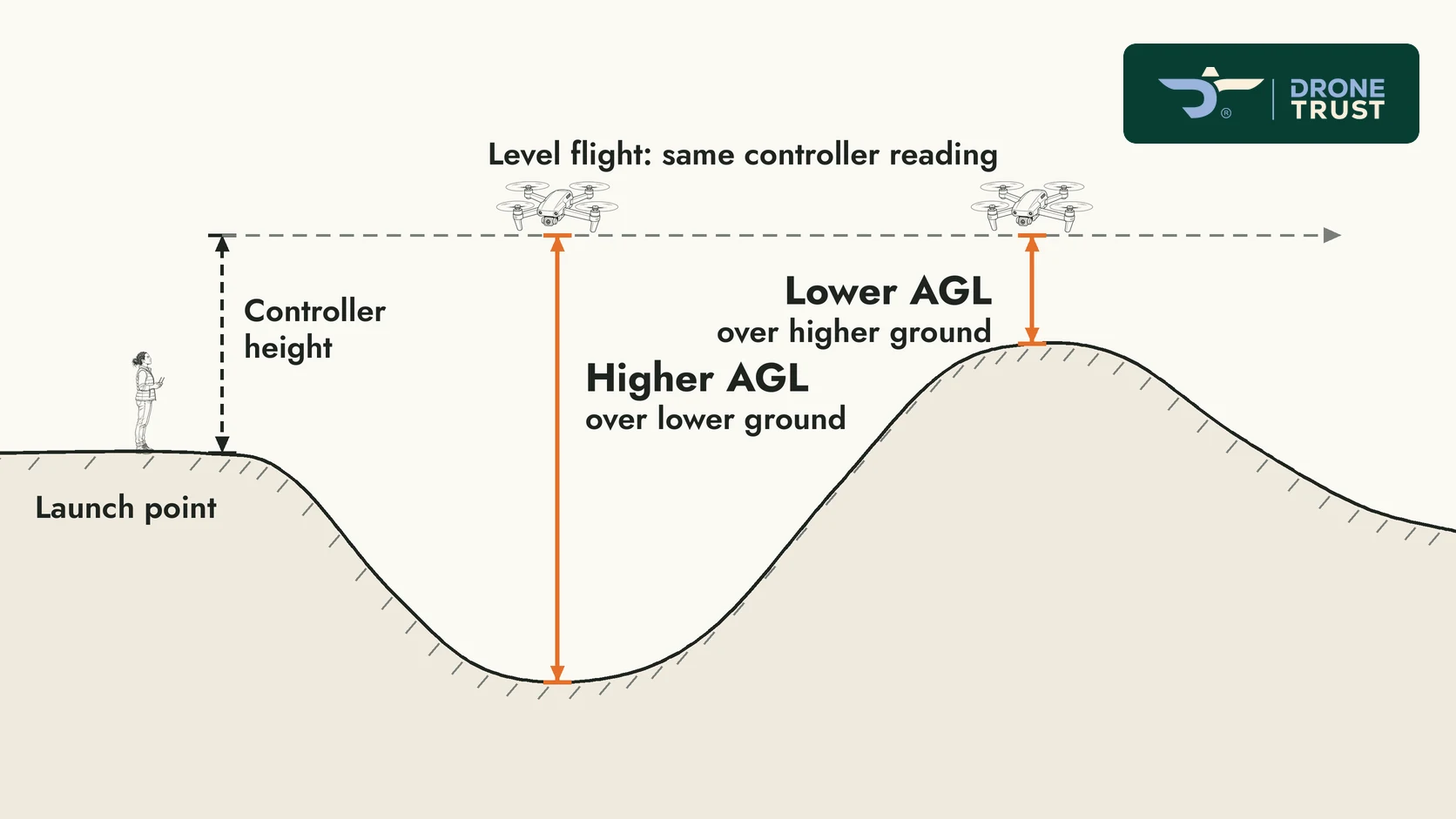
Line drawing of a drone flying over rising and falling ground.
L2.4-G1 Open The drawing has no numbers. Would you like example heights on it?
Carried over from the Lesson 2.5 build (17 Nov).
L2.5-C1 Open The worked-example step text is only in the full-screen activity (as in 2.2/2.3); "What This Example Demonstrates" stays in the lesson. OK?
L2.5-C2 Open The activity's short wording is ours. Please check it.
Orchard boundary plan
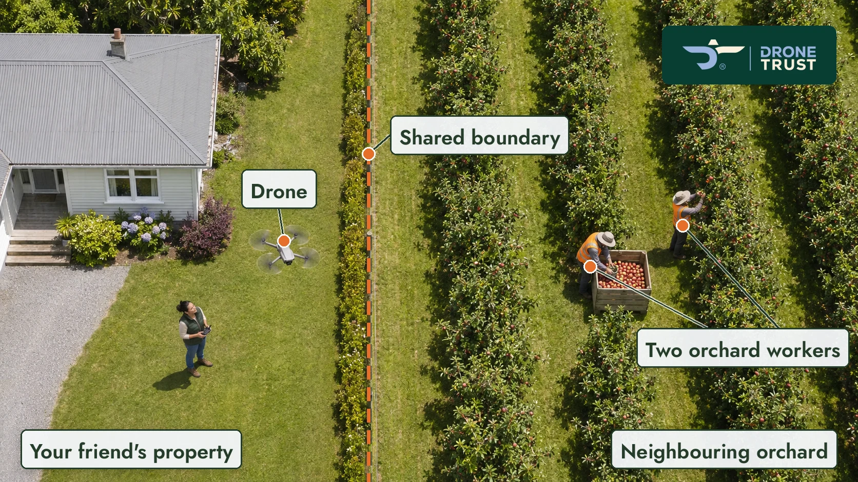
Aerial photo of an orchard with the permitted flying area drawn over it.
L2.5-G1 Open The orchard and walkway plans are aerial photos with drawn overlays, not line drawings. Is that the look you want?
L2.5-G2 Open The labels on these plans are our wording. Please confirm or replace them.
Coastal walkway plan
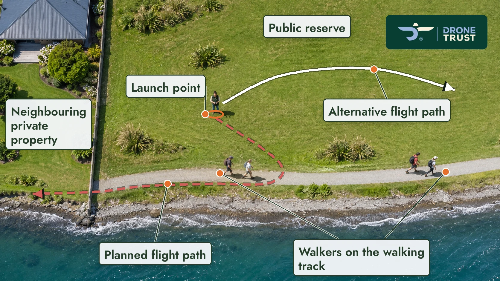
Aerial photo of a coastal walkway with the flight area drawn over it.
No open questions.
Carried over from the Lesson 2.6 build (17 Nov).
Sports ground worked example (original plan)
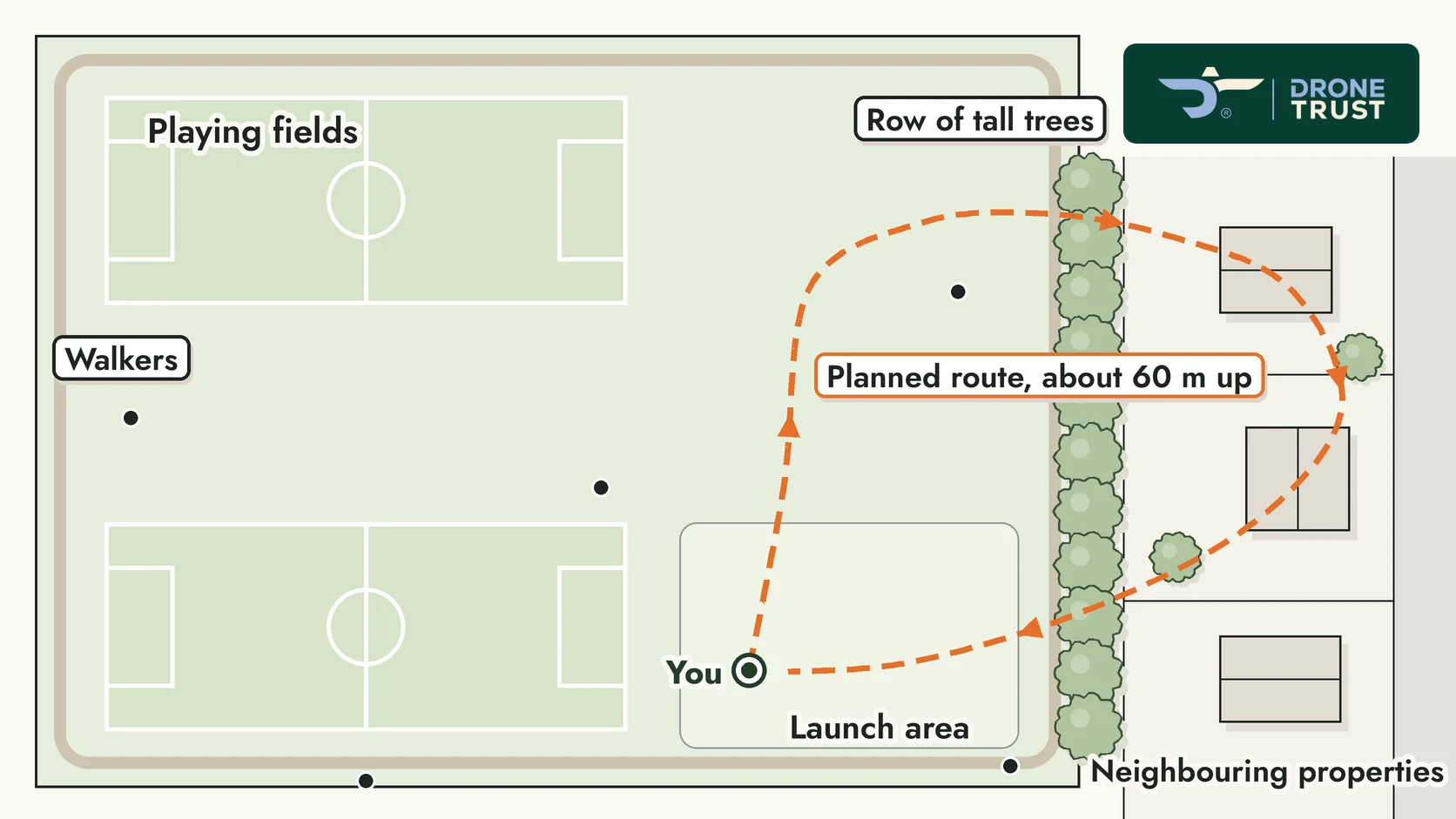
Plan of the sports ground with the first proposed route.
L2.6-G1 Open The short labels on the 2.6 plans ("Permission not checked", "Trees may block your view", "Within the permitted area, in sight, clear of walkers", "Still to check: permission, airspace and location", "Area that may be permitted") are our wording. Please confirm or replace them.
Sports ground worked example (modified route)
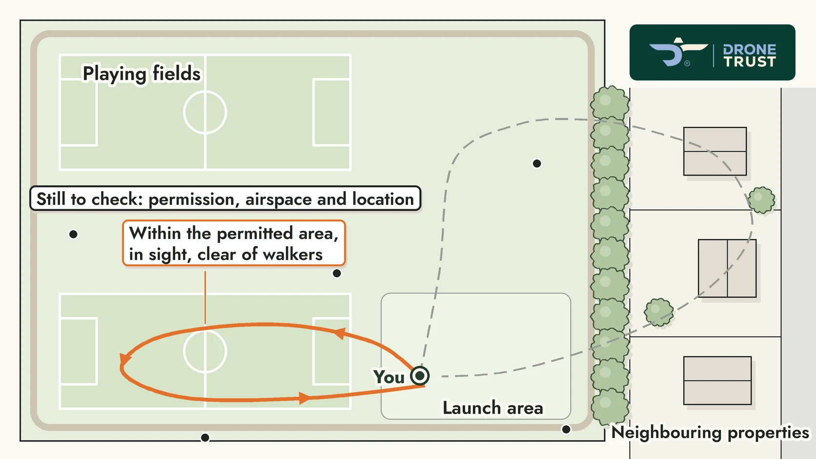
The same sports ground with the modified route.
L2.6-G2 Open The modified route (and the lakeside "area that may be permitted") are illustrative; your master gave no exact positions. Are they reasonable?
Clive: Change to "Four particularly useful resources". (19 Nov)
Clive: Keep the other aircraft as the Threat; the knowledge gap is an EPC. (19 Nov)
Clive: Standardise to Undesired Aircraft State (UAS). (19 Nov)
Clive: Make ARR explicit (seeing/hearing the aircraft = Recognise); keep delay/modify/abandon under PAD without blending the two models. (19 Nov)
Clive: Add: "A Notice to Airmen (NOTAM) provides important information about temporary changes or hazards affecting aviation." How to check them comes later. (19 Nov)
Clive: Airspace has both horizontal and vertical boundaries; a change in either can affect the airspace a drone occupies. Align the takeaway. (19 Nov)
Clive: Happy with it. (19 Nov)
Clive: Keep bold in the box, consistent with earlier lessons. (19 Nov)
Opening scenario
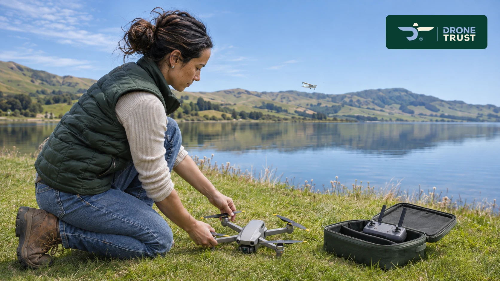
Pilot kneeling by her drone beside a calm lake, small aeroplane far across the water.
No open questions.
§3 Horizontal and vertical boundaries
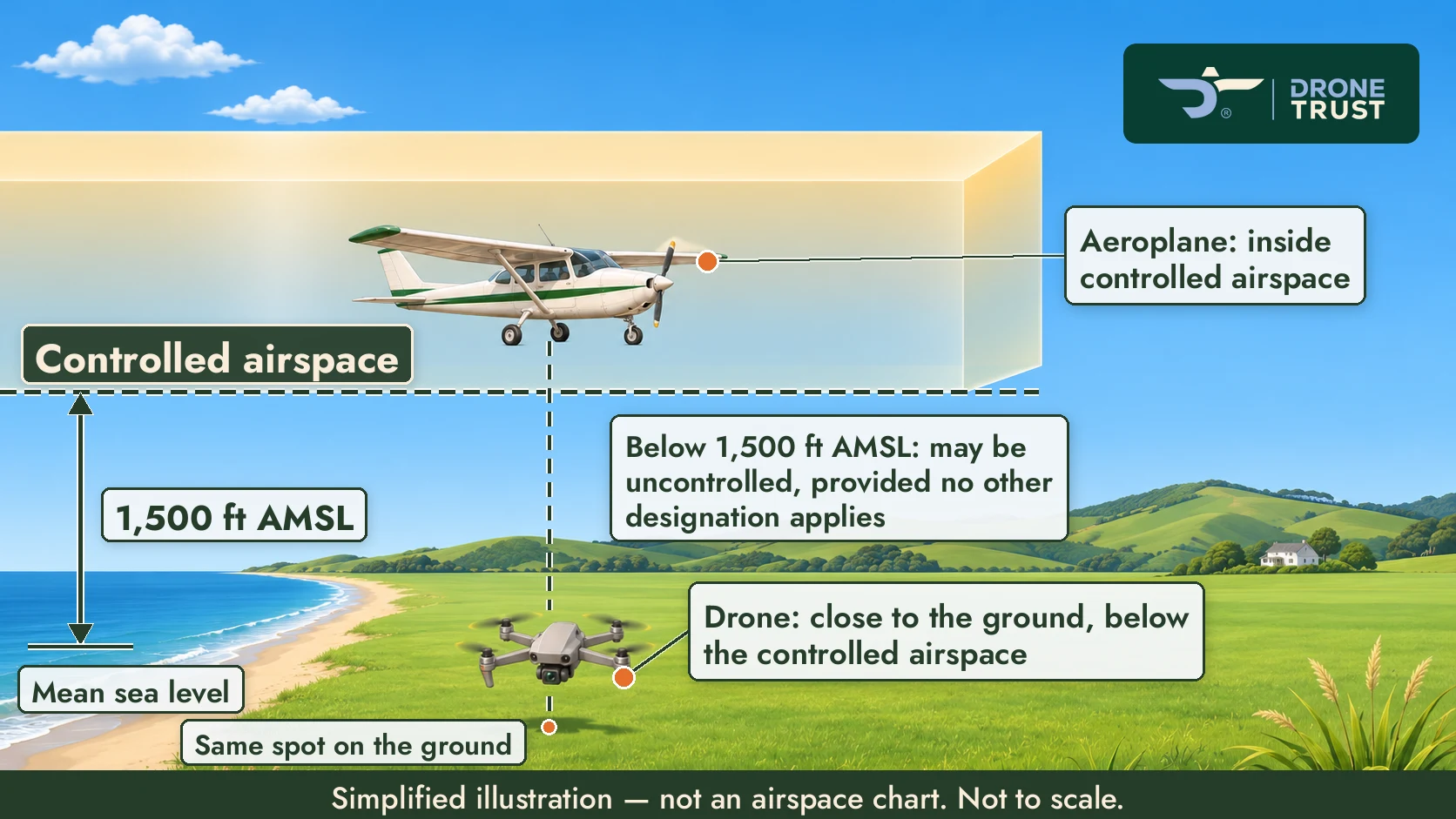
Poster-style illustration: controlled airspace starting at 1,500 ft AMSL, aeroplane inside it, drone below it, same spot on the ground.
No open questions.
§4 Where can you find airspace information?
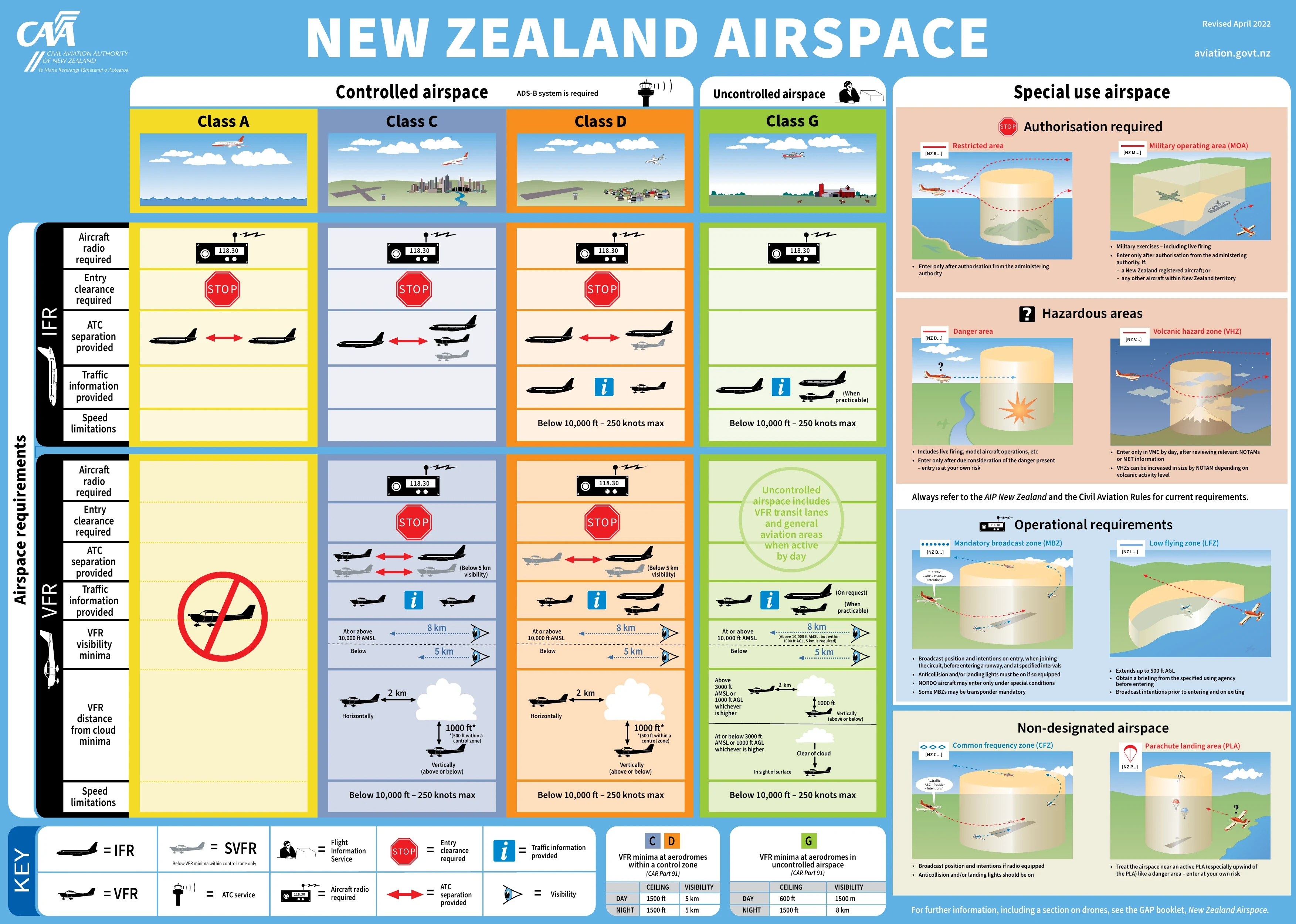
The CAA New Zealand Airspace poster, unaltered and credited, tap to enlarge.
No open questions.
L3.2-C1 Open The §2 tap activity shows a short version of your words, with your full Controlled / Uncontrolled text (including "Working With Air Traffic Control" as a green tip box) directly below it, so a few sentences appear twice. Keep it, or move the full text into the activity?
L3.2-C2 Open We bolded a few of your lines: "Don't let uncertainty…", "Uncontrolled does not mean unrestricted.", the "distinction" sentence after the table, and the Pilot's Takeaway. Keep or remove?
§1 What does ATC actually do?
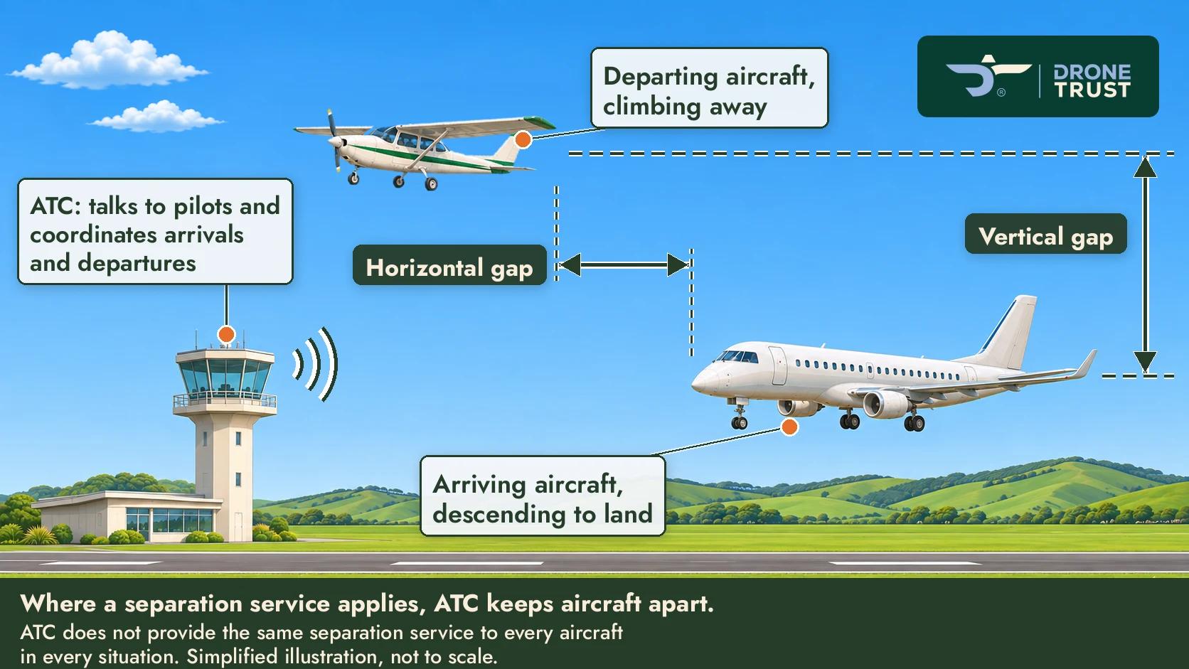
ATC tower with an arriving regional jet and a departing light aeroplane, a horizontal gap and a vertical gap, no distances.
L3.2-G1 Open At many towers an airliner and a light aeroplane wouldn't actually be separated from each other. Happy with this pair, or prefer two similar aircraft, or a neutral label such as "Movements coordinated"?
§2 Two environments (tap activity): controlled

Busy airport environment, one of the two tappable pictures.
L3.2-G2 Open The DroneTrust badge is left off the two activity pictures because on a phone it would cover about a third of each one. OK?
§2 Two environments (tap activity): uncontrolled
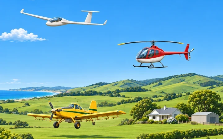
Rural countryside environment, the other tappable picture.
No open questions.
§4 The same landscape, different airspace
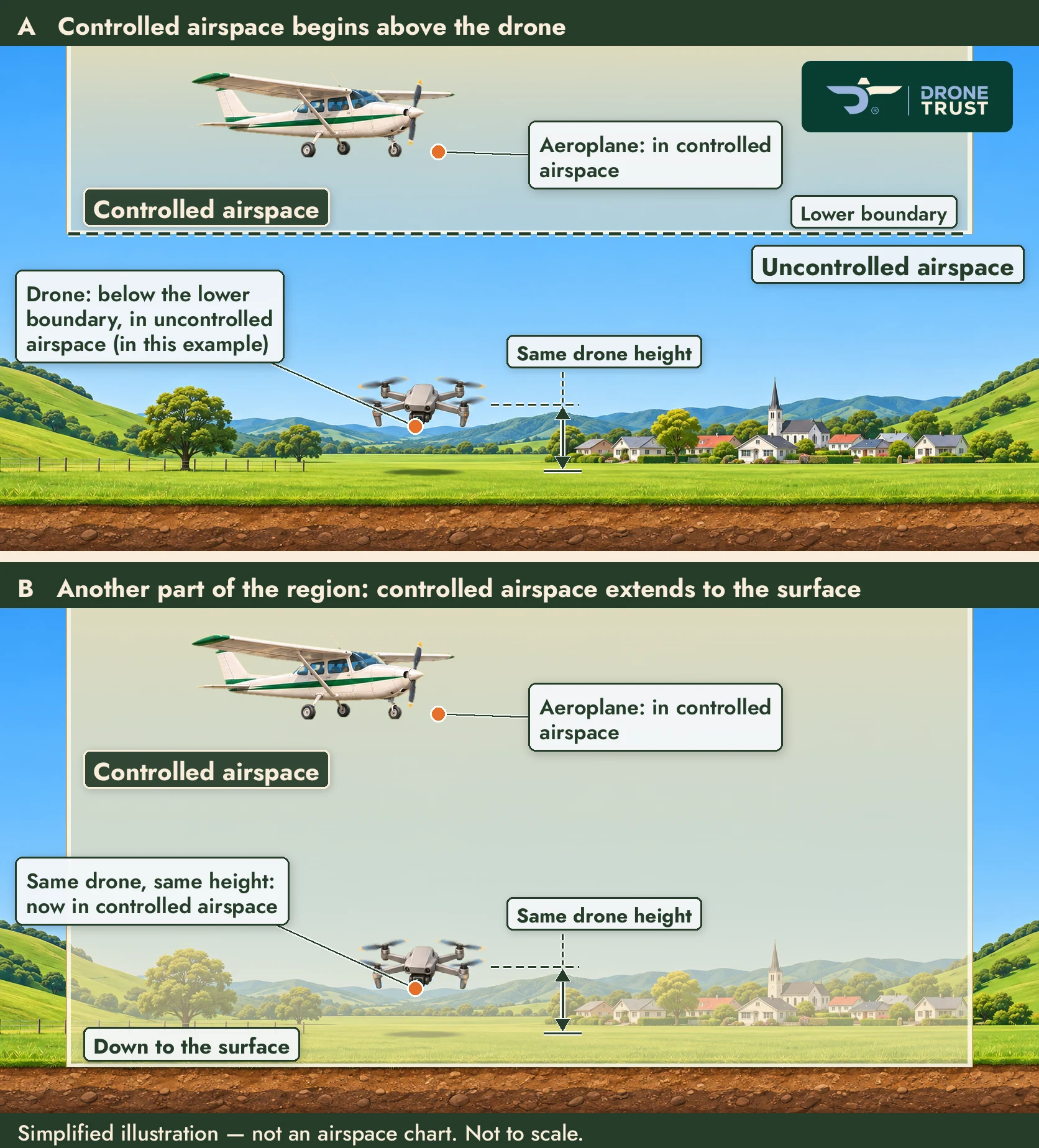
Two cross-sections from one picture: controlled airspace above the drone (A) and down to the surface (B), drone at the same height in both.
No open questions.
L3.3-C1 Open Your Position A/B/C sentences appear only inside the §5 activity, revealed on tap. Should they also be printed in the lesson?
L3.3-C2 Open The activity shows a short line we wrote for each position: "Inside the Control Zone (CTR): controlled airspace" / "Beneath the CTA, outside the CTR: uncontrolled airspace in this example" / "Inside the Control Area (CTA): controlled airspace". Approve or reword?
L3.3-C3 Open Would you like a short TEM link (e.g. other aircraft below a CTA as a Threat, judging the boundary by height above launch as an Error), or is the Pilot's Takeaway enough?
L3.3-C4 Open Rule 101.11 now says "prior authorisation from the ATC unit… unless the operation is a shielded operation". The lesson says "ATC clearance". Keep "ATC clearance" for learners, or align to the rule?
L3.3-C5 Open Apply It: a drone kept 100 ft above a hilltop launch site may be much higher above the valley floor. Mention it in the model response, or leave it to §7 and the later altitude lesson?
L3.3-C6 Open In the §5 table the CTR column is bold and the CTA column isn't (kept as in your master). Intentional?
§4 Upside-down wedding cake (also the §5 Explore the Airspace activity)
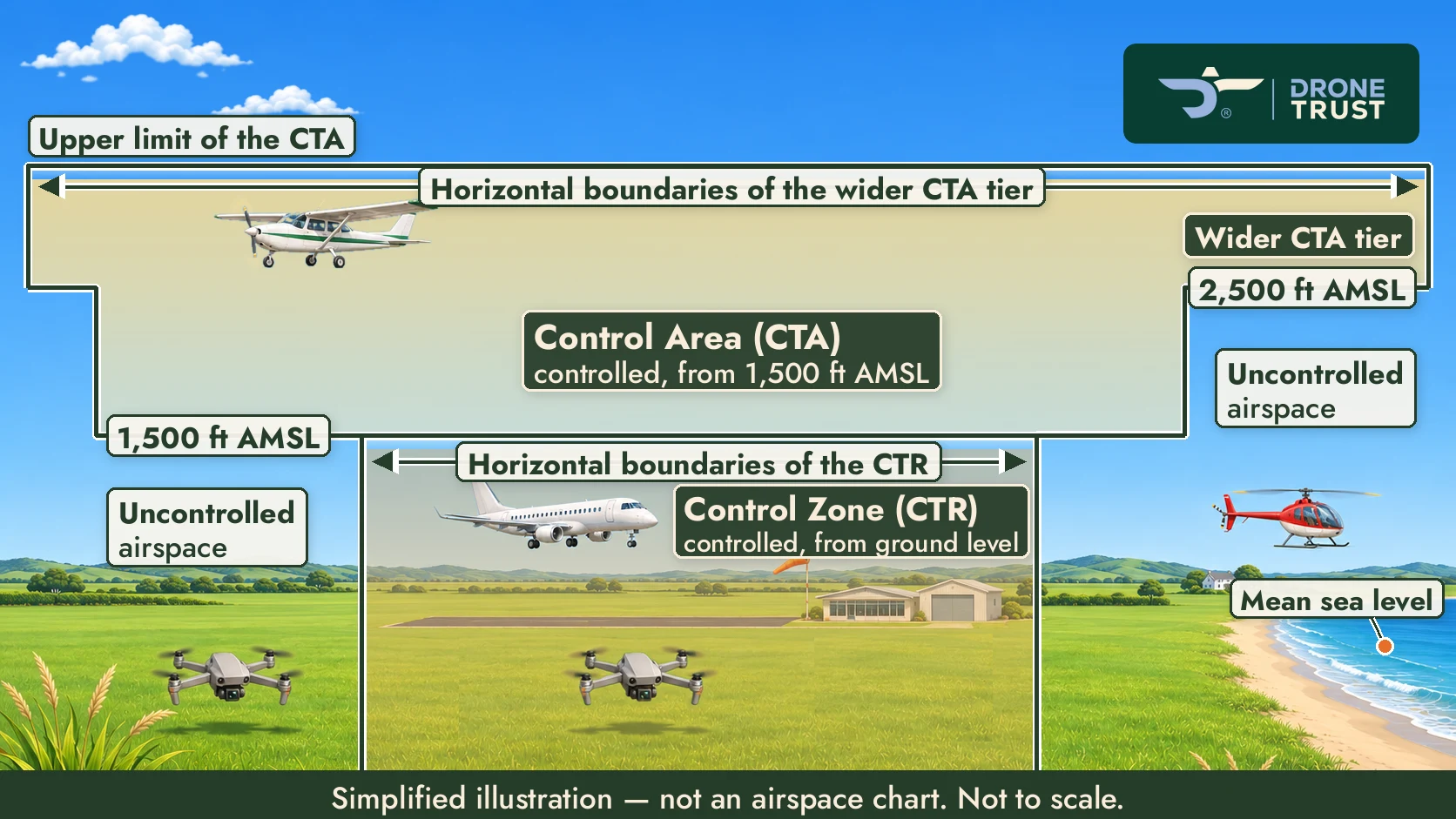
CTR from the ground around the airport, CTA tiers at 1,500 ft and 2,500 ft AMSL widening above, uncontrolled airspace below; jet landing, drones A and B, aeroplane C in the CTA, helicopter well away from the drones.
L3.3-G1 Open Is one wedding-cake picture enough (used in §4 and the §5 activity), or would you like a crop of it beside §2 (CTR) or §3 (CTA)?
L3.3-G2 Open The picture adds a second, wider CTA tier at 2,500 ft AMSL (illustrative), and aeroplane C flies in it. Apply It also uses 2,500 ft. Happy with both, or use a different number in one?
L3.4-C1 Open Rules 101.7(a)/(b) don't say "active", but the AIP talks about approval to enter an active area. Is it right to teach that approval for R and M areas is needed even outside the published activity period (as your worked example does)?
L3.4-C2 Open Low Flying Zones: keep "local administering authority", or use the AIP's term "using agency"?
L3.4-C3 Open The worked example's key distinction appears on the widget's last screen and again just below it in the lesson. Keep both?
L3.4-C4 Open Danger Areas wording vs rule 101.7(c): see CATI-C4 at the top of this page.
§2/§3
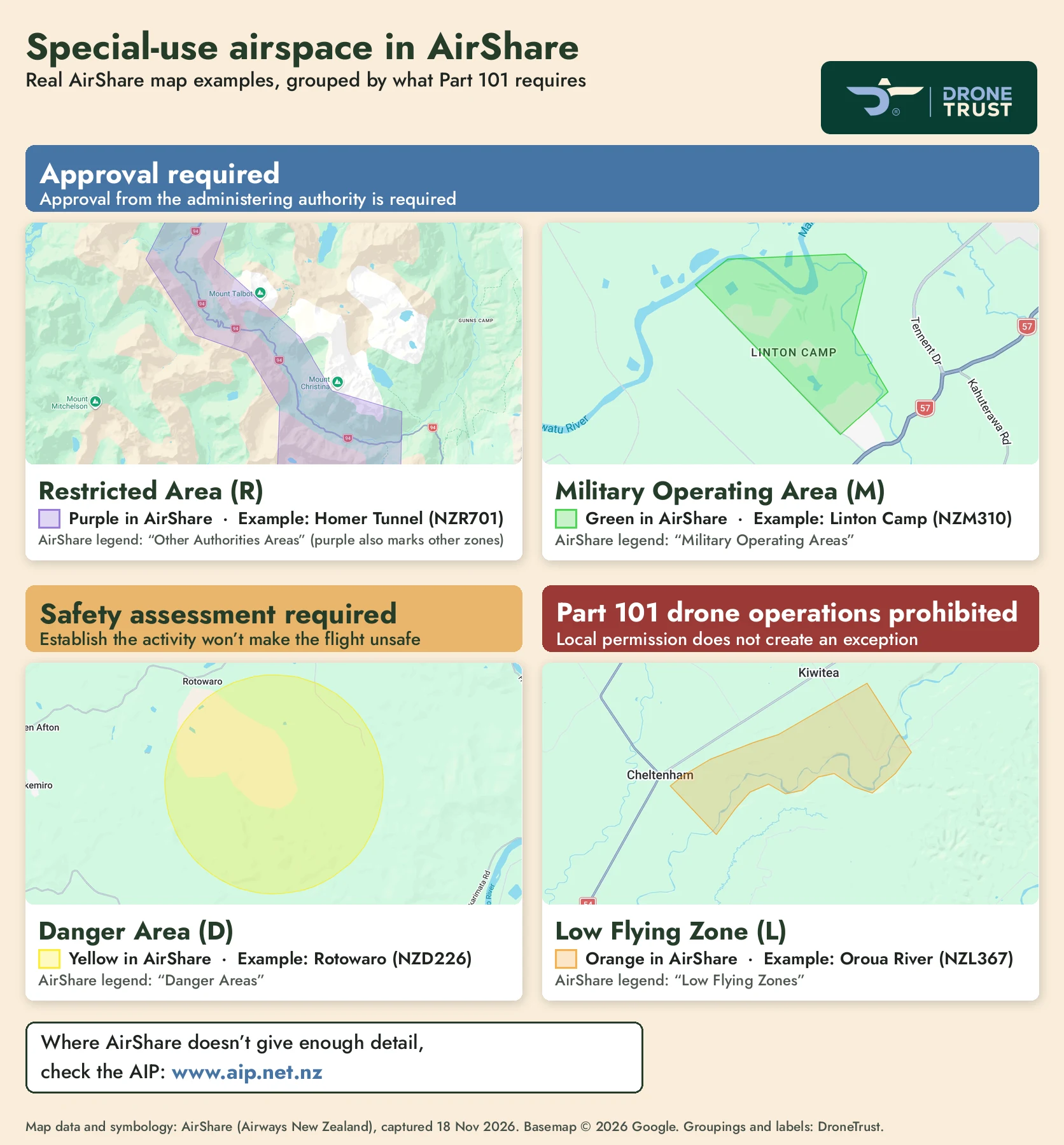
Real AirShare map crops (captured 18 Nov 2026) of R Homer Tunnel (NZR701), M Linton Camp (NZM310), D Rotowaro (NZD226) and L Oroua River (NZL367), grouped: approval required (R, M), safety assessment (D), prohibited (L). AirShare's own colours and legend names.
L3.4-G1 Open AirShare lists restricted areas as "Other Authorities Areas" and uses the same purple for other zones; the graphic and caption say so. Clear enough for learners?
L3.4-G2 Open Please approve the wording we added: group headers, labels and caption.
§2 Finding the Responsible Authority
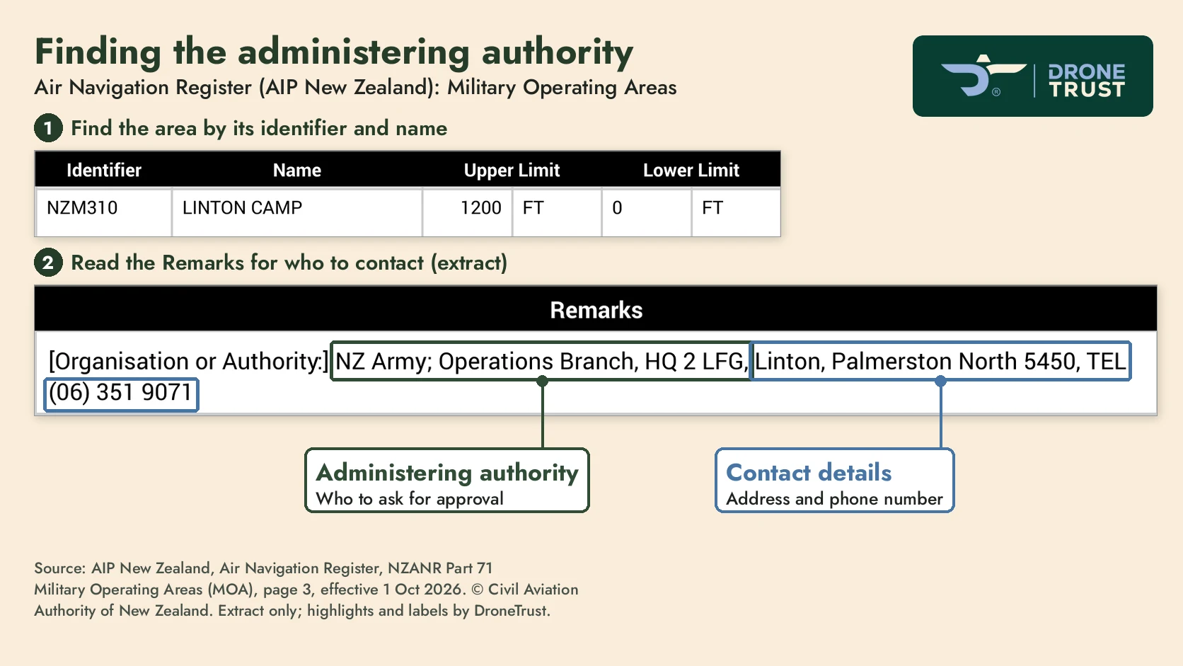
Real Air Navigation Register extract for NZM310 Linton Camp (AIP, effective 1 Oct 2026) with the administering authority and contact details highlighted. A line mentioning "UAS activity" was cropped out to avoid clashing with the course's UAS = Undesired Aircraft State.
L3.4-G3 Open Is this the right register entry to show, and is cropping the "UAS activity" line OK?